
Location
| FAA Identifier: | Z84 |
| Lat/Long: | 64-18-01.4000N 149-06-59.5000W 64-18.023333N 149-06.991667W 64.3003889,-149.1165278 (estimated) |
| Elevation: | 559.4 ft. / 170.5 m (surveyed) |
| Variation: | 27E (1985) |
| From city: | 3 miles SE of CLEAR, AK |
| Time zone: | UTC -9 (UTC -8 during Daylight Saving Time) |
| Zip code: | 99704 |
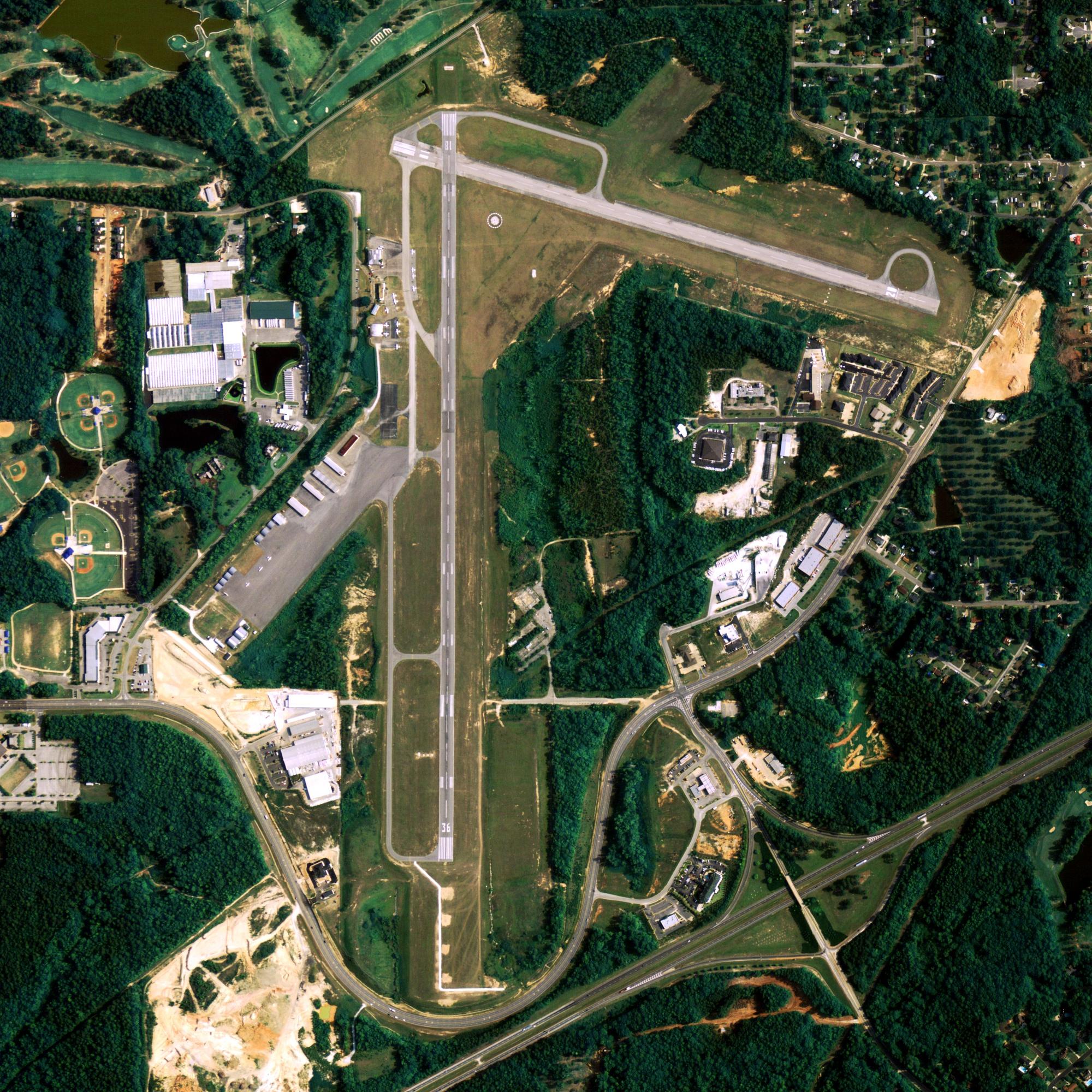
Runway Information
Runway 1/19
| Dimensions: | 3997 x 100 ft. / 1218 x 30 m | ||
| Surface: | asphalt, in good condition SAFETY AREA – 300 FT OVERRUN AT EACH END. |
||
| Runway edge lights: | medium intensity | ||
| Runway edge markings: | RY 01/19 MKD WITH THLD MARKERS. | ||
| RUNWAY 1 | RUNWAY 19 | ||
| Latitude: | 64-17.752108N | 64-18.295653N | |
| Longitude: | 149-07.414865W | 149-06.570100W | |
| Elevation: | 559.4 ft. | 543.3 ft. | |
| Traffic pattern: | right | left | |
| Markings: | nonprecision, in good condition | nonprecision, in good condition | |
| Touchdown point: | yes, no lights | yes, no lights | |
| Obstructions: | 45 ft. trees, 360 ft. from runway, 130 ft. left of centerline, 3:1 slope to clear | 52 ft. trees, 1520 ft. from runway, 105 ft. left of centerline, 25:1 slope to clear | |
Some nearby airports with instrument procedures:
- PANN – Nenana Municipal Airport (15 nm N)
- PAHV – Healy River Airport (26 nm S)
- PAFA – Fairbanks International Airport (45 nm NE)
- PAFB – Ladd Army Airfield (50 nm NE)
- PAEI – Eielson Air Force Base (57 nm NE)
Clear Quick Info
Country: USA
State: Alaska
Coordinates 64°15′22″N 149°11′08″W
Time zone
UTC-9 (Alaska (AKST))
What to do In
Clear
- NA
Where To Stay In
Clear
- NA
Where To Eat In
Clear
- NA