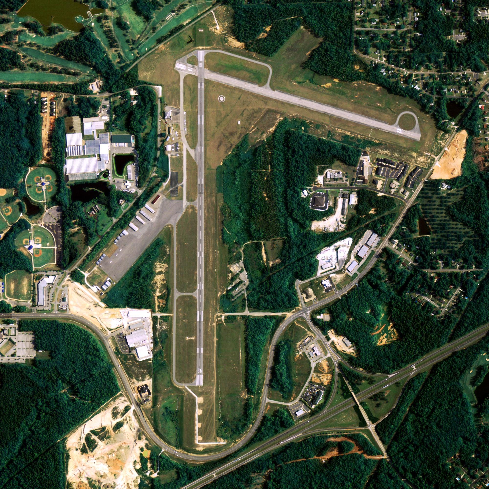
Location
| FAA Identifier: | BRW |
| Lat/Long: | 71-17-05.5000N 156-46-06.9000W 71-17.091667N 156-46.115000W 71.2848611,-156.7685833 (estimated) |
| Elevation: | 48.9 ft. / 14.9 m (surveyed) |
| Variation: | 19E (2010) |
| Time zone: | UTC -9 (UTC -8 during Daylight Saving Time) |
| Zip code: | 99723 |
Runway Information
Runway 7/25
| Dimensions: | 7100 x 150 ft. / 2164 x 46 m | ||||||||||
| Surface: | asphalt/grooved, in fair condition | ||||||||||
| Weight bearing capacity: |
|
||||||||||
| Runway edge lights: | high intensity | ||||||||||
| RUNWAY 7 | RUNWAY 25 | ||||||||||
| Latitude: | 71-17.092092N | 71-17.092678N | |||||||||
| Longitude: | 156-47.926612W | 156-44.302297W | |||||||||
| Elevation: | 48.6 ft. | 37.4 ft. | |||||||||
| Traffic pattern: | right | left | |||||||||
| Runway heading: | 071 magnetic, 090 true | 251 magnetic, 270 true | |||||||||
| Displaced threshold: | 600 ft. | 600 ft. | |||||||||
| Declared distances: | TORA:7100 TODA:7100 ASDA:6500 LDA:5900 | TORA:7100 TODA:7100 ASDA:6500 LDA:5900 | |||||||||
| Markings: | precision, in good condition | precision, in good condition | |||||||||
| Visual slope indicator: | 4-light PAPI on right (3.00 degrees glide path) | 4-light PAPI on left (3.00 degrees glide path) | |||||||||
| RVR equipment: | touchdown | rollout | |||||||||
| Approach lights: | MALSR: 1,400 foot medium intensity approach lighting system with runway alignment indicator lights | ||||||||||
| Runway end identifier lights: | yes | ||||||||||
| Touchdown point: | yes, no lights | yes, no lights | |||||||||
| Instrument approach: | ILS/DME | ||||||||||
| Obstructions: | none | 9 ft. ant, 380 ft. from runway, 200 ft. right of centerline, 20:1 slope to clear | |||||||||
Other nearby airports with instrument procedures:
PATQ – Atqasuk Edward Burnell Sr. Memorial Airport (51 nm S)
PAWI – Wainwright Airport (74 nm SW)
Barrow Quick Info
Country: USA
State: Alaska
Area
21.48 sq mi (55.63 km2)
Coordinates 71°17′26″N 156°47′19″W
Population
4,488 (2018 est)
Density: 1,072.63/sq mi (414.15/km2)
Time zone
UTC−9 (Alaska (AKST))


